Mar 25 2023
Odyssey Advanced Land Navigation


The Odyssey Advanced Land Navigation Clinic will be an information-packed day of compass, topographical map study and orienteering in Roanoke. This will be a fun day consisting of minimum classroom study with more emphasis on day and night field work. You will learn from knowledgeable instructors with years of adventure racing, hiking and backcountry experience. You will learn techniques that are proven to work and more importantly how to work together with a team to navigate successfully.
There will be 3 hours of classroom instruction and 7-9 hours of field work finding plotted points using the skills you have learned. We will cover between 8-10 miles, on foot at a slow and learning pace, mostly off trail through thick brush, open forest and steep hillsides.
The Odyssey Advanced Navigation Clinic will explain:
Techniques to use to know where you are on your map at all times
What to do if you have lost contact with your map
Teach how to transition from one map to another and keep all the information flowing
How to use terrain features, compass, and altimeter to figure out your location
Advanced route selection techniques
When to use pace count versus time verses terrain features or all at the same time
Teach how to use land features to your advantage during the day and night
Nighttime navigation techniques
How and when to use intentional offset, triangulation
Navigation on the bike and "must have" tools and how to use them
Navigation on the water
It is HIGHLY recommended that you have completed an Odyssey Land Navigation Clinic or some other navigation course before registering for this clinic. You will need to know and have practiced the following skills. We will spend little if any time the teaching the skills below:
Know the different types of maps
Know different types of map scales
Know how to use all the information on a topographical map
Identify land features on a map
Know how to identify land features in the field
Know how to use a compass and its different features
Understand and use declination
Know how to measure and plot a bearing on the map
Know how to take and follow a bearing in the field
Know how to plot UTMs (Universal Transverse Mercator)
Know how to make and use a plotting tool for a map of any scale


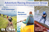
 SleepMonsters